Our Smart(er) City methodology

 
Iterations.png

ABSTRACT

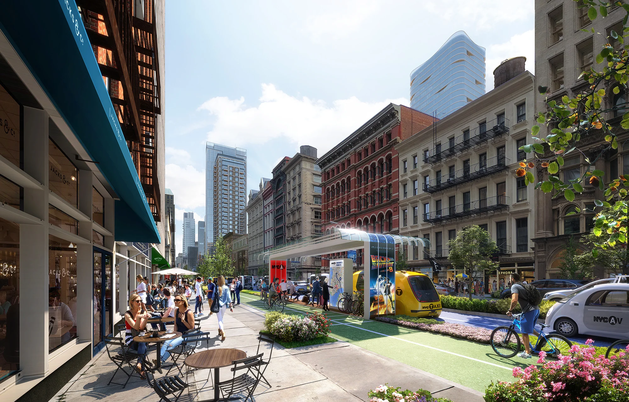
The current process for the design of an urban master plan typically involves a team of architects and urban planners that conceive a handful of schemes based on zoning requirements with the help of CAD software. They may intend for the plan to achieve a set of performance goals (economic, environmental, etc.), but quantitative analysis is rarely conducted early and consistently through the design process. This makes it difficult to understand the full range of approaches that are possible on a site, and the relative performance of each scheme. In order to best accommodate rapid urbanization while making cities more sustainable, livable, and equitable, designers must utilize quantitative tools to make informed decisions about their designs. Computational design techniques have been successfully used at the building scale to test numerous designs and quantify their performance, but are challenging to apply at the urban scale due to increased computational expense, difficulty in limiting inputs, and more stakeholders involved in the process. This paper outlines a methodology developed in practice for applying computational design at the urban scale through four steps: 1) Simplified Input Definition 2) Procedural Geometry Generation, 3) Performance Evaluation and 4) Analysis & Communication to generate and test thousands of master planning scenarios.

You can download the paper here!

Explore the design space from the Demonstration section here!

Our Director Luc Wilson traveled to Delft to present our paper on exploring potential frameworks for performance based zoning. 

SIMAUD_2018

ABSTRACT

Exponential growth is pressuring cities around the world to reevaluate their management of new development. Challenges stemming from such growth, including crises in affordable housing and transit accessibility, see cities responding by constructing ever greater densities, a process limited by current zoning regulations. Traditional zoning frameworks are rigid and slow to adapt, making it difficult for development to keep pace with greater density requirements. By establishing certain baseline urban metrics tied to a set of performance standards, performance-based zoning allows cities to proactively accommodate growth and demand while mitigating potential negative externalities. One of the primary challenges for a truly performance-based zoning methodology is defining and calibrating desired performance standards. Cities must consider criteria associated with, for example, comfort, mobility, and activity in such a way that defines achievable, goal-oriented benchmarks– a difficult task given the complexity of urban systems. In proposing a process for creating a performance-based zoning framework, this paper: 1) explores urban analysis methods, focusing on urban comfort, mobility, and activity, to create new urban performance datasets for Manhattan for use in establishing new zoning protocols, and 2) develops new visualization techniques that can more effectively engage stakeholders, make data understandable and accessible for decisionmakers, and broaden the discussion to involve a wider range of non-specialist participants.

You can download the paper here!

Using Data and Design to Develop an Autonomous Transit System for NYC

In collaboration with ARUP, MIT, IBM and Data & Society.

As we question the nature of the urban landscape, we predict a world with renewed public space and a better life for millions of New Yorkers. AV technologies will act as a catalyst, transforming the city into a place of more connection and activity, and redefining what it means to be “urban” for cities around the world.

KPF_DriverlessNY_CleanAir_LoRes.jpg

A reinvention of public transportation requires thorough understanding of all of the city’s intricacies and a design approach that is far outside of the box. With leading specialists at IBM, Arup and MIT, KPF is working to develop urban data and performance analytics and machine learning models to evaluate the opportunities for an integrated AV transit system. With greater knowledge about population densities, demographics, traffic patterns, street geometries, and subway capacity, we can explore the number of people a new system can support, density and growth factors, and ideal trip distances. 


Moreover, we can analyze the possibilities for street redesign, implementation and phasing, and land use changes across the city. Improved accessibility will dramatically alter land use and development trends citywide. Commercial and manufacturing can be paired with residential zones, connected by AV corridors that alleviate long and inefficient commutes. This new approach to mobility may lead us to adjust zoning policies and encourage a more balanced distribution of growth.


Current and proposed dedicated transit network.

Without rezoning, under-built sites with new transit access can meet NYC growth projections for 2030: House 1/2 million people and60 million sq ft office.

Without rezoning, under-built sites with new transit access can meet NYC growth projections for 2030: House 1/2 million people and60 million sq ft office.


We propose a network of AV corridors that will proliferate throughout the five boroughs, enabling New York to offer more equitable and effective transit, and redesign its streets for the comfort and benefit of its citizens. AV routes can act as a complement to existing transportation services, and connect to many areas of the city that are currently under-served.

New AV street types for wide and narrow streets

Multi-modal Streets: The promis of semi-autonomous transit.

Multi-modal Streets: The promis of semi-autonomous transit.


AVs operate with a vastly different set of assumptions than today’s cars, using advanced communication technologies that make them more efficient and safe. Their enhanced predictability will eventually allow entire lanes of traffic to be eliminated from the current streetscape, opening the space up for sidewalks and public use. New street typologies will be designed to accommodate the new infrastructure and allow New York to reprioritize the pedestrian and add acres of green space.  With the advent of AVs, New York can implement a new street design and zoning strategy that offers the most value for its most important asset – its people.


(A more complete version of the video can be found here.  This has also been published as part of the Urban Design Forum's Onward: Mobility in the Next New York.)


On-Going Research

Urban Pulse: Capturing the Rhythm of Cities

In collaboration with The Visualization and Data Analytics (ViDA) lab at the NYU School of Computer Science and Engineering.

Fabio Miranda, Marcos Lage, Harish Doraiswamy, Kai Zhao, Bruno Gonçalves, Luc Wilson, Mondrian Hsieh, Cláudio Silva

Abstract

Cities are inherently dynamic. Interesting patterns of behavior typically manifest at several key areas of a city over multiple temporal resolutions. Studying these patterns can greatly help a variety of experts ranging from city planners and architects to human behavioral experts. Recent technological innovations have enabled the collection of enormous amounts of data that can help in these studies. However, techniques using these data sets typically focus on understanding the data in the context of the city, thus failing to capture the dynamic aspects of the city. The goal of this work is to instead understand the city in the context of multiple urban data sets. To do so, we define the concept of an “urban pulse” which captures the spatiotemporal activity in a city across multiple temporal resolutions. The prominent pulses in a city are obtained using the topology of the data sets, and are characterized as a set of beats. The beats are then used to analyze and compare different pulses. We also design a visual exploration framework that allows users to explore the pulses within and across multiple cities under different conditions. Finally, we present three case studies carried out by experts from two different domains that demonstrate the utility of our framework.

Using Design Technology to Explore the Implications of the New York City Zoning Amendment for Quality and Affordability

In collaboration with The Center for Urban Real Estate (CURE.) at Columbia University.

Jesse M. Keenan, Luc Wilson, & Mondrian Hsieh

Abstract

This paper represents a critical methodological and technological advancement in engaging the broader public discourse as to the precise impacts of urban development and associated zoning calibrations. The “Zoning for Quality andAffordability” amendment to the New York City (NYC) zoning code is the first city- wide zoning effort since 1961 (ZQA). The legislative intent of the ZQA is to provide greater flexibility for accommodating economically viable housing production within the context of promoting a wider range of design alternatives that advances both housing and contextual urban quality. The research design is centered on evaluating the spatial distribution and geometric characteristics of lots subject to the ZQA rules across NYC (Macro Analysis), as well to evaluate the daylight access and visibility impacts associated with lots within each of the applicable zoning districts (MicroAnalysis). The Macro Analysis evaluates the extent to which the ZQA is addressing larger development constraints within existing rules relative to underbuilt lots. The Micro Analysis tests the hypothesis that environmental impacts from the ZQA are marginal and are not consistent with a broader public critique of the overwhelming negative impacts of the ZQA. The results of the Macro Analysis support the legislative intent of the ZQA and the results of the Micro Analysis support an affirmation of the hypothesis. To the contrary, a majority of districts are projected to experience positive measured impacts.

Urbane: A 3D Framework to Support Data Driven Decision Making in Urban Development

In collaboration with The Visualization and Data Analytics (ViDA) lab at the NYU School of Computer Science and Engineering.

Nivan Ferreira, Marcos Lage, Harish Doraiswamy, Huy T. Vo, Luc Wilson, Heidi Werner, Muchan Park, Cláudio Silva

Abstract

Architects working with developers and city planners typically rely
on experience, precedent and data analyzed in isolation when making
decisions that impact the character of a city. These decisions
are critical in enabling vibrant, sustainable environments but must
also negotiate a range of complex political and social forces. This
requires those shaping the built environment to balance maximizing
the value of a new development with its impact on the character
of a neighborhood. As a result architects are focused on two issues
throughout the decision making process: a) what defines the character
of a neighborhood? and b) how will a new development change
its neighborhood? In the first, character can be influenced by a
variety of factors and understanding the interplay between diverse
data sets is crucial; including safety, transportation access, school
quality and access to entertainment. In the second, the impact of a
new development is measured, for example, by how it impacts the
view from the buildings that surround it. In this paper, we work
in collaboration with architects to design Urbane, a 3-dimensional multi-resolution framework that enables a data-driven approach for
decision making in the design of new urban development. This is
accomplished by integrating multiple data layers and impact analysis
techniques facilitating architects to explore and assess the effect
of these attributes on the character and value of a neighborhood.
Several of these data layers, as well as impact analysis, involve
working in 3-dimensions and operating in real time. Efficient computation
and visualization is accomplished through the use of techniques
from computer graphics. We demonstrate the effectiveness
of Urbane through a case study of development in Manhattan depicting
how a data-driven understanding of the value and impact of
speculative buildings can benefit the design-development process
between architects, planners and developers.

Topology Based Catalogue Exploration Framework for Identifying View-Enhanced Tower Designs

In collaboration with The Visualization and Data Analytics (ViDA) lab at the NYU School of Computer Science and Engineering.

Harish Doraiswamy, Nivan Ferreira, Marcos Lage, Hut T. Vo, Luc Wilson, Heidi Werner, Muchan Park, Cláudio Silva

Abstract


There is a growing expectation for high performance design in architecture
which negotiates between the requirements of the client
and the physical constraints of a building site. Clients for building
projects often challenge architects to maximize view quality
since it can significantly increase real estate value. To pursue this
challenge, architects typically move through several design revision
cycles to identify a set of design options which satisfy these view
quality expectations in coordination with other goals of the project.
However, reviewing a large quantity of design options within the
practical time constraints is challenging due to the limitations of
existing tools for view performance evaluation. These challenges
include flexibility in the definition of view quality and the ability
to handle the expensive computation involved in assessing both the
view quality and the exploration of a large number of possible design
options. To address these challenges, we propose a catalogue based
framework that enables the interactive exploration of conceptual
building design options based on adjustable view preferences.
We achieve this by integrating a flexible mechanism to combine
different view measures with an indexing scheme for view computation
that achieves high performance and precision. Furthermore,
the combined view measures are then used to model the building
design space as a high dimensional scalar function. The topological
features of this function are then used as candidate building designs.
Finally, we propose an interactive design catalogue for the exploration
of potential building designs based on the given view preferences.
We demonstrate the effectiveness of our approach through
two use case scenarios to assess view potential and explore conceptual
building designs on sites with high development likelihood in
Manhattan, New York City.

The Science of Supertall

Luc Wilson and Jesse Keenan, Center for Urban Real Estate, Columbia University.

Description

The virtues and drawbacks of supertall skyscrapers in New York are the subject of much debate, but their true impact is hard to measure in the absence of an analytical approach. MAS partners Columbia’s Center for Urban Real Estate and KPF will delve into the “science of supertalls,” presenting a series of quantitative methods and qualitative interpretations for understanding the nature of new development in urban contexts. This analytical approach is contextualized by projects from around the world.

Presentation given at the Municpal Art Society, 2015 Summit for the City of New York.